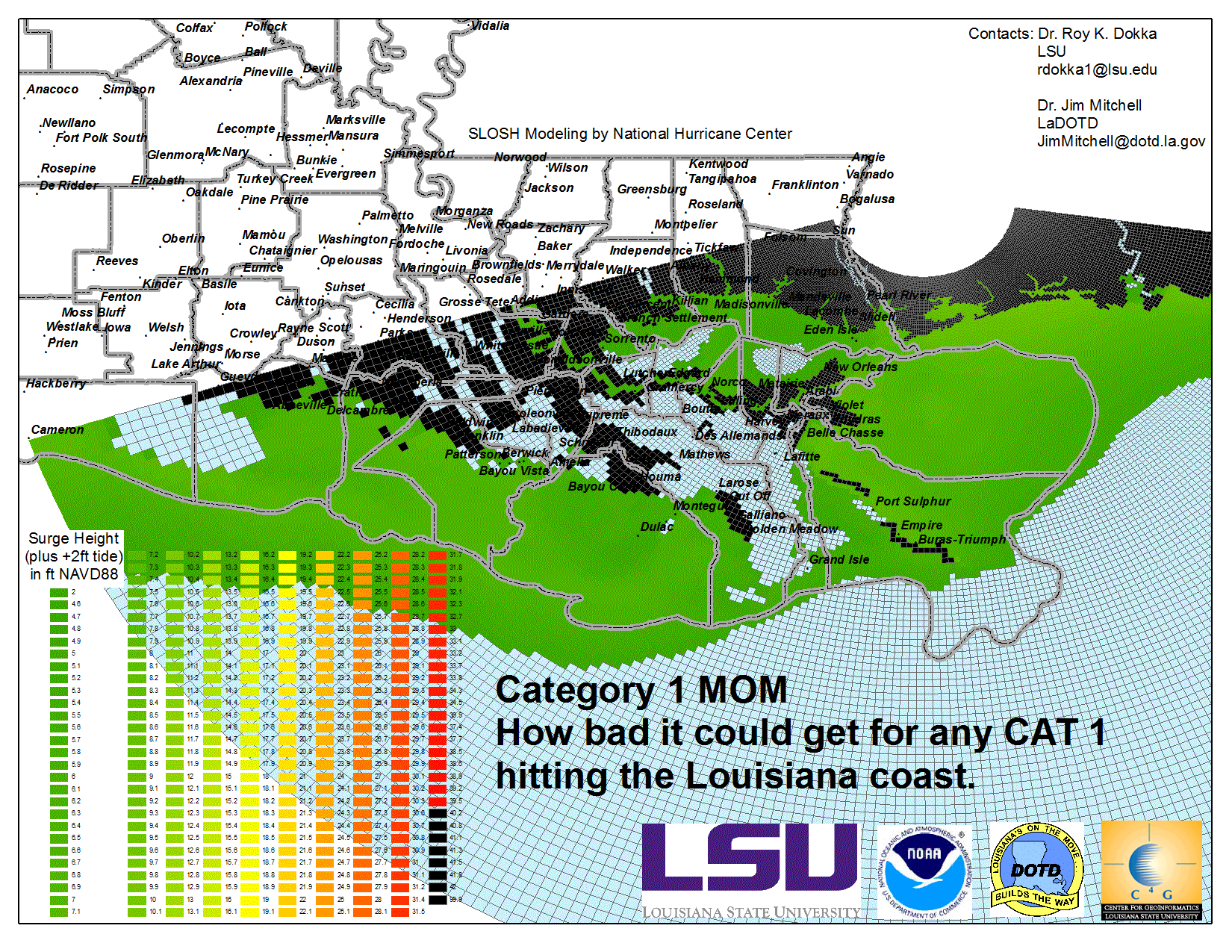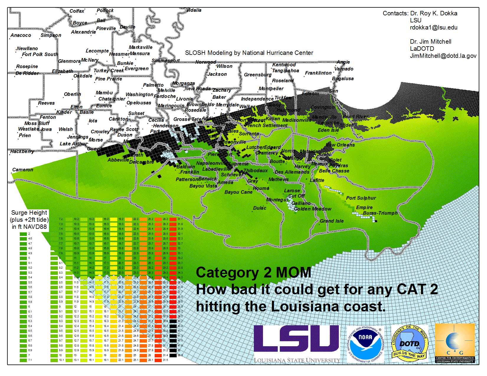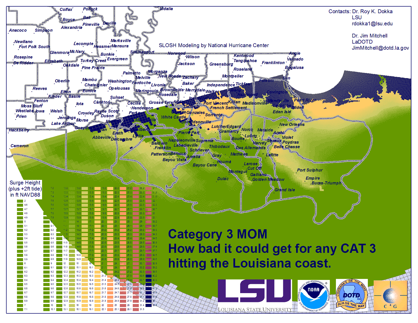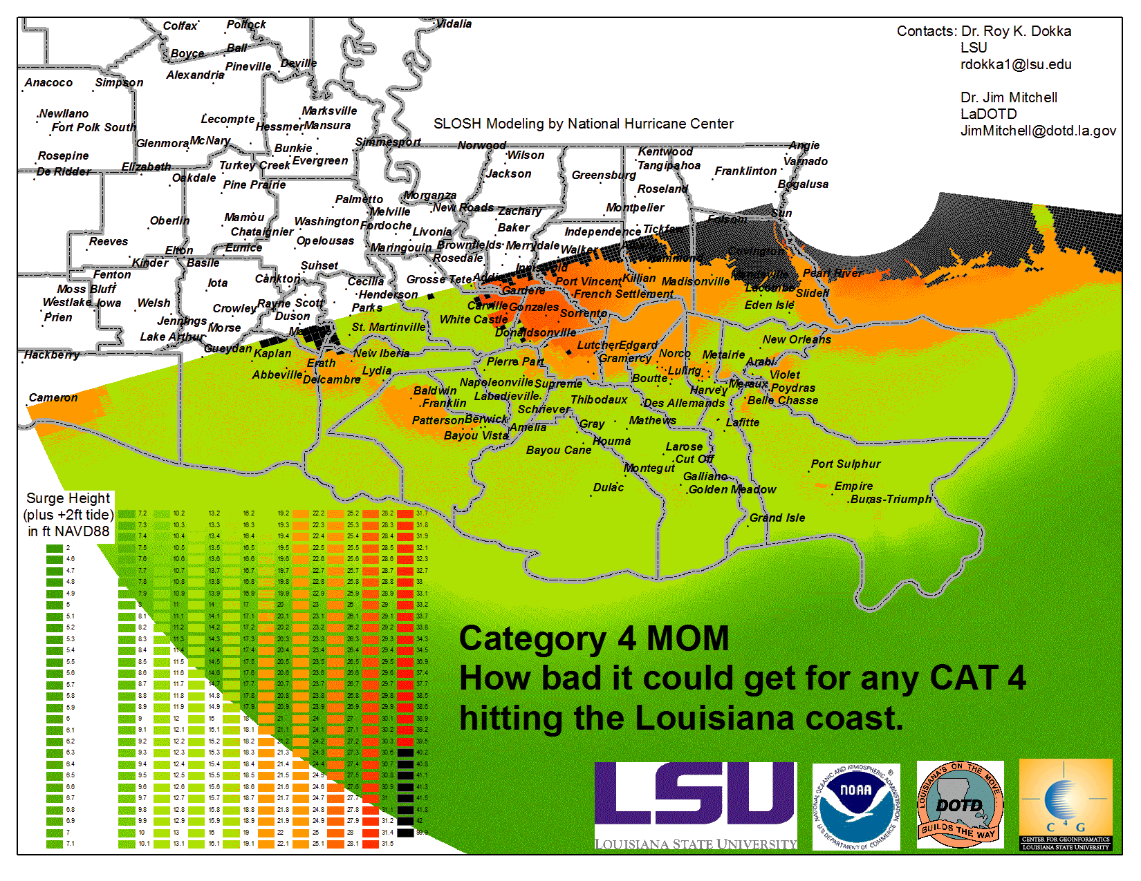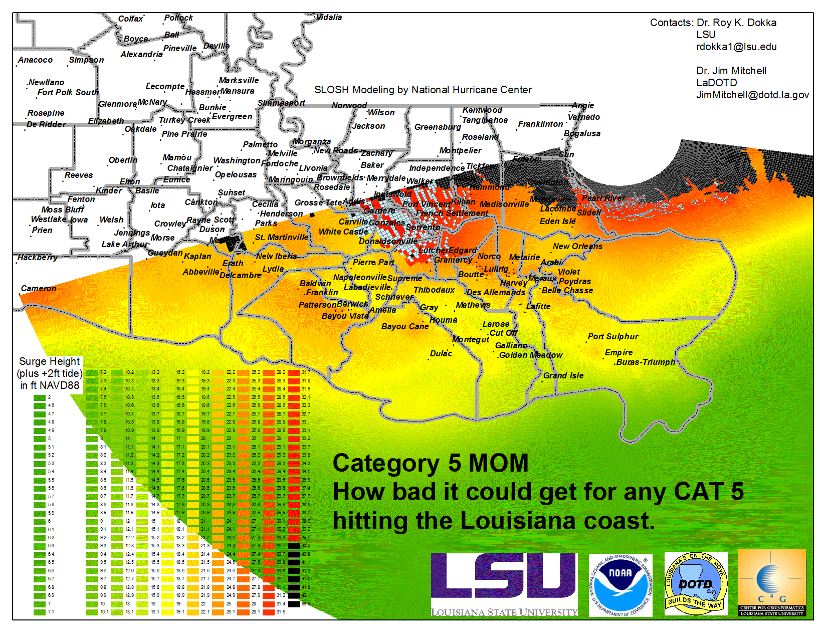
LOUISIANA STORM SURGE MAXIMUM OF MAXIMUM (MOM) MAPS
Select from the thumbnails below to see storm surge maximum of maximum (MOM) water levels and inundation models for each category hurricane hitting southern Louisiana. MOM's are the best tool we currently have to show the surge generated by storms that can strike an area. Surge is greatly affected by small differences in storm direction, speed, size, intensity, landfall location, and when necessary, tide level. The NHC calculates the surge from thousands of storms that vary all those factors, holding only Saffir-Simpson category as a constant. For every small area in the model only the highest calculated surge in each S-S category is saved and mapped as shown. There is only one MOM for each category. No single storm will cause the entire depicted storm surge inundation, but the highest surge at each location has been mapped. THESE MAPS SHOW THE WORST CASE SCENARIO FLOODING FOR ANY GIVEN POINT ON THE COAST. IF TOLD TO EVACUATE BY AUTHORITIES, DO IT!