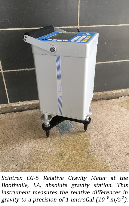
 The Center for GeoInformatics (C4G) in the Department of Civil and Environmental Engineering (CEE) recently received new geodetic instruments to model the Earth’s gravity field. A Scintrex CG-5 Relative Gravity Meter, Leica T60 Total Station, and Trimble R10 GPS Rover Kit were acquired as part of an enhancement grant sponsored by the Louisiana Board of Regents. Drs. George Voyiadjis (PI) and Joshua Kent (Co-PI) led the one-year project, which ended in June, 2017. The instruments are acquired to address the needs of three objectives: First, to develop a novel, high-resolution gravity model of sea level (i.e., geoid); second, to augment knowledge of existing subsidence rates and the driving mechanisms; and finally, promote advanced geodetic research at the University.
Here, as in many river deltas around the world, land surfaces are sinking due to subsidence. On average, southern Louisiana experiences ~10 millimeters per year of subsidence. Understanding the mechanisms that drive subsidence is essential for mitigating risk and promoting sustainability. The CG-5 relative gravity meter supports these goals by measuring the relative differences in the Earth’s gravity across southern Louisiana. 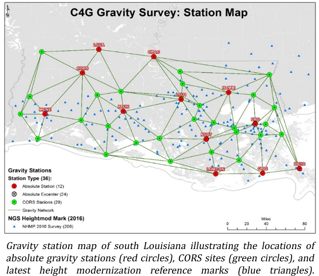 Surveys using the total station and R10 rover kit are currently underway to geodetically correlate the CG-5 data with absolute gravity readings collected in the early 2000s by the National Geospatial-Intelligence Agency and the National Geodetic Survey. The updated gravimetric surveys conducted by C4G researchers and staff will deliver much needed insight into the variety of geophysical processes driving the spatially and temporally heterogeneous rates of subsidence measured across the state.
In addition to the subsidence research, this enhancement grant will directly and indirectly benefit Louisiana’s geodetic stakeholder and consumer communities. For nearly a decade, the C4G has provided tools, services, and other geodetic resources dedicated to precise positioning throughout the state and across the region. 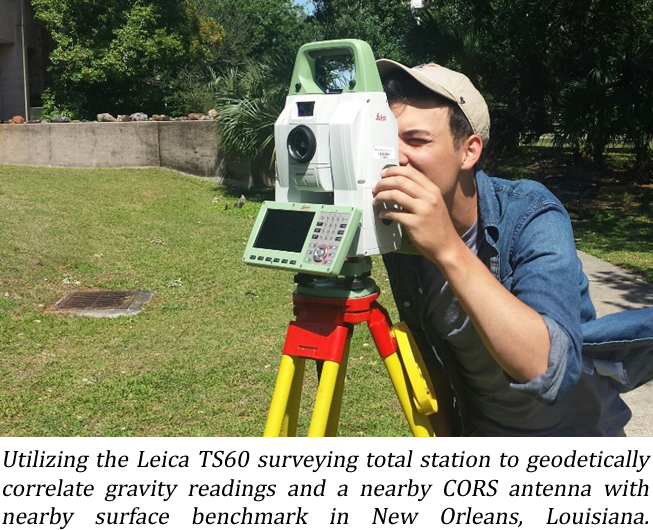 Central to these resources is the C4GNet real-time reference network. The network includes more than 50 continuously operating GPS reference stations (CORS) installed across Louisiana.
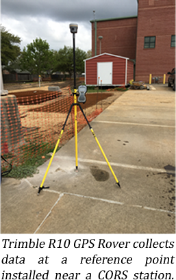 Over the next five years, the C4G plans to geodetically correlate the gravity measurements with antenna heights at each station. Extended surveys will include CORS in neighboring states. When completed, the data will contribute to the creation of a novel, high-resolution geoid model that will allow the geodetic community to accurately and precisely measure elevations above sea level.
The instruments acquired by this grant represent an investment into the geodetic research capacity at the C4G and CEE. In addition to the above goals and objectives, these resources have already been selected for use by investigators in two external funding proposals, both of which will rely on the precision of these instruments to deliver meaningful geodetic solutions. These instruments not only promote research activities, they have galvanized national and international collaborations with partners across the US Gulf Coast and western Europe. More information about these instruments and geodetic models is available at the C4G website www.c4g.lsu.edu or gravity.c4g.lsu.edu.
 November 26, 2018
BATON ROUGE, LA – Throughout the month of October, 10 members of the National Geospatial-Intelligence Agency visited LSU’s campus and other statewide GPS sites to take gravity measurements for a research project spearheaded by LSU Center for Geoinformatics (C4G) Chief of Geodesy Cliff Mugnier.
Every five to 10 years, the NGA takes measurements of the earth’s gravity field to check for subsidence, a project Mugnier has been working on for nearly 30 years.
“LSU has the largest university-owned network of permanent GPS stations in the world, which reach from Louisiana throughout the Gulf Coast,” Mugnier said. “Over the years, I have asked the military to come in to take measurements at these stations. I first go to the New Orleans Corps of Engineers, whose colonel then writes a letter to the Pentagon asking if they can come to Louisiana and observe different places where we have our GPS antennas for our research on subsidence. The idea is if you come back to the same spot over a period of years and see an increase in the strength of the earth’s gravity, that means you’re getting closer to the center of the earth, which equates to subsiding.”
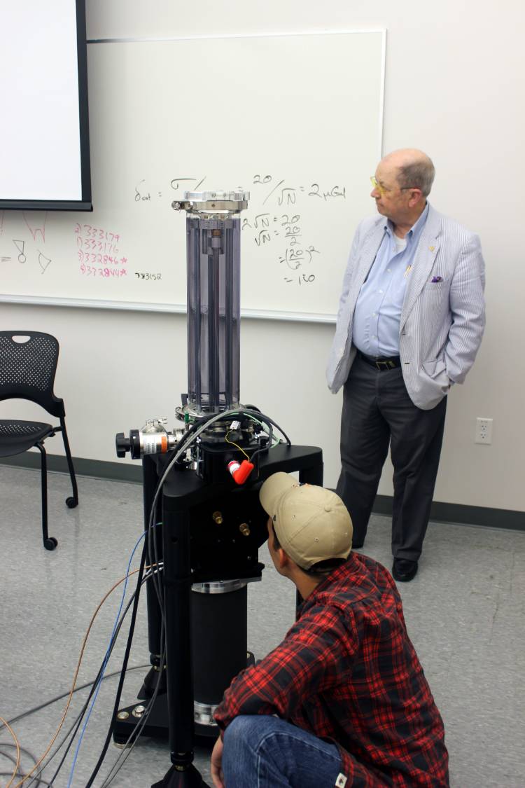
The NGA kicked off its recent Louisiana trip at LSU’s Absolute Gravity Station using instrumentation similar to the FG5-X Absolute Gravity meter that C4G purchased this year. C4G also houses two CG5 Relative Gravity meters. From LSU, the NGA team—consisting of two groups of five trainees from New Mexico, Whiteman Air Force Base in Missouri, and both the East and West Coasts—moved on to other GPS core sites across south Louisiana that included Oakdale, Alexandria, New Orleans, Slidell, Boothville, Lafayette, Lake Charles, Cocodrie, and Grand Isle. The NGA will take measurements in north Louisiana this winter to conclude their 2018 Louisiana campaign.
“The reason for these gravity measurements is to have a completely independent physical measurement of vertical movement as a function of gravity, rather than readings from the GPS satellites,” Mugnier said. “It all fits together for the subsidence research, but another reason is when people mortgage their homes, the banks require them to have flood insurance, which is based on elevation. The Corps [of Engineers] is also interested in subsidence because they have the responsibility of levees and flood control.”
The NGA hasn’t visited Louisiana since 2003, shortly after Mugnier arrived at LSU. Though subsidence is of vast importance to Louisianans, the NGA does not take measurements every year because subsidence is a slow process.
“If you do it too frequently, the observations get lost in what is called white noise,” Mugnier said. “Even though the instruments are super precise, you still have to have the time for the sinking to be enough for the instruments to detect.”
Mugnier’s research on Louisiana subsidence began when he taught at the University of New Orleans, where the first NGA measurements were taken in 1989. Since then, research has shown that UNO’s campus is sinking at a rate of 9.1 mm/year, which Mugnier said is significant when you consider that equates to 3 feet in 100 years.
“Three feet is a whole lot when you also consider sea level is rising about 2 mm each year,” he said.
Since the first reading taken at LSU around 2003 by the National Geodetic Survey, it has been discovered that LSU’s campus is subsiding around 5 mm/year near the fault line on Nicholson Drive. The campus is on the downside of the fault.
Since subsidence is an unstoppable force, Mugnier has made sure that C4G will continue his research when he is no longer at LSU. The man who started C4G, LSU Professor Roy K. Dokka, established the organization whose mission is in keeping with state law that says C4G is the source to keep track of elevations for the state of Louisiana.
“So, we have an organization that’s going to be here long after I’m gone,” Mugnier said. “And we have the perfect research project that will go on forever.”
###
Contact: Center for GeoInformatics
Join C4G to learn how the coming 2022 Datum will impact advanced positioning in Louisiana and everything you need to know about the NSRS
A new Datum is coming and it will impact advanced positioning in Louisiana, attend this event to learn everything you need to help improve the future of the NSRS in Louisiana.
Tuesday, June 22, 2021 - 1:00 PM – 5:00 PM CDT
Add this event to your Calendar

The Following Topics Will Be Featured
Join the LSU Center for GeoInformatics to learn about the exciting findings and potential of our partnership with NASA’s Jet Propulsion Lab (JPL), what legislation we need for the La. State Plane System in the NSRS going forward, and about our GPS on Benchmarks achievements and find out how you can contribute to and benefit from the GPSonBM project.
- Cathleen Jones Ph.D., Radar Scientist @ JPL - INSAR Updates
- Galen Scott, NGS Constituent Resources Manager @ NOAA - GPS on BM Achievements
- J. Anthony Cavell, PLS, Surveyor @ C4G - 2022 Legislature
- GPS of BM call to action – procedure on how to share your data
- Closing remarks
Don't miss this opportunity to learn from the experts how the Coming Datum change will impact the National Spatial Reference System!
Register to get your attendee link now!
Join C4G to learn how the coming 2022 Datum will impact advanced positioning in Louisiana and everything you need to know about the NSRS.
Friday, August 23, 2019 - 8:00 AM – 5:00 PM CDT
Add this event to your Calendar

The Following Topics Will Be Featured
- The Future of the National Spatial Reference System
- How the 2022 Datum Change will impact Louisiana
- Louisiana's Terrestrial Gravity Studies
- GEOID model Improvements for Louisiana
- Louisiana State NSRS Legislation
- Expert Panel Discussions - Q & A
Don't miss this opportunity to learn from the experts how the 2022 Datum change will impact the National Spatial Reference System!
Seats are limited so get your's now! Click Here to Register
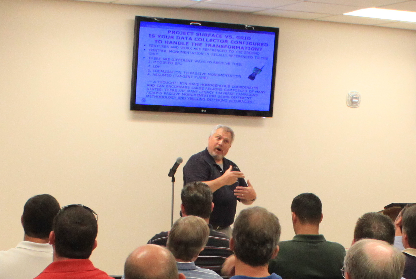 The LSU Center for GeoInformatics hosted a training session on Best Methods to Achieve Accurate, Repeatable Orthometric Heights Using Real Time GNSS Networks. The event was held at the Orleans Parish Levee District Offices in New Orleans, Louisiana on August 15th 2012. The event was attended by over 60 individuals including surveyors, engineers, local, state and federal government officials.
Some of the topics covered were:
- Vertical Geodetic Control in Southern Louisiana
- Providing the National Spatial Reference System in dynamic regions
- Intro to GNSS
- Guidelines for Establishing GPS-derived Ellipsoid Heights
- Guidelines for Establishing GPS-derived
- Orthometric Heights
- Improvements to the Geoid Model
- Real-time Kinematic Surveying and Best Practices
- Introduction to Real-time Networks
The South Louisiana Flood Protection Authority District - East has made these trainings a Requirement for Professionals Working for the Levee District. Surveyors and Engineers that attended also received 8 Continuing Education Credits. The training provided professional Land Surveyors the requisite training to properly use an RTN system such as GULFNet or C4Gnet to provide current correct elevations. The main speaker was Bill Henning of NGS, one of the premier experts in the GNSS applications field. Registration, food and refreshments were handled by LSPS District 1 and plans are currently in the works to host additional events of this type in Baton Rouge and Shreveport in the near future.
If you are interested in attending one of these training events please sign up for the C4G mailing list or follow C4G in social media on Twitter, Facebook or the C4Gnet RSS feed. You can also find Podcasts, PDF's and Videos of past events on the C4G website or the C4G YouTube channel.